Roadkill Project History
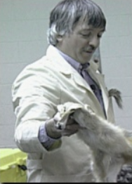
The RoadKill project started in 1992 as part of a National Science Foundation teacher enhancement grant called EnviroNet, awarded to Simmons College in Boston. A NH teacher, Brewster Bartlett, also known as Dr.Splatt, began the idea of monitoring dead animals along the roadway as he traveled back and forth from his school. He thought it would make a good project for students to not only learn the different kinds of animals that are found along the roadways but also to keep in touch with each other via the emerging Internet at the time.
When the project was first conceived in 1992 there was no access to the web and the only means of keeping in touch and sending along various data was via email messages that were posted to a bulletin board. As the web became available the project went through a series of modifications and changes for collection, submittal and retrieval of data and as a result communication between students and schools was greatly enhanced.
Over the past few years the RoadKill project lost its technical support and the submission of data to an online database was no longer possible. Many classrooms still participated but were finding it hard to "see" the bigger picture not having access to data from others. Fortunately, Edutel.org stepped up and provided a means to collect and share data.
As the years progressed, schools participating shifted and our school started posting on this website. Some of the first few years data has been lost, but we have continued our involvement with a minimum of counting the roadkill.
New Technology
Our school now has the ability to geospatially map the data. This will add another dimension to the data collection and analysis. Our students have the ability to create GIS maps using ArcGIS software from the New Hampshire Educational GIS Partnership, http://www.nhedgis.org/.
